 |
|
You are here: OGC Public Wiki>CanadaForum Web>WebHome (12 Apr 2024, RosieChen)Edit Attach
Welcome to the CanadaForum web
Introduction
The goal of the Canada Forum is to better serve Canadian needs for geospatial data and services. The Forum is an informal organization open to all Canadian Organizations (including non-OGC members) and international OGC members conducting business or research in Canada. Examples of organizations include, but are not limited to, Federal, Provincial, Territorial, and Municipal governments, Indigenous Organizations, Academia, and Industry. The Canada Forum will provide a platform for all stakeholders to increase collaboration with a focus on Canada's requirements for sharing geospatial data and information, capacity building, innovation, outreach, industry business development, and others. The forum is also intended to provide a venue for the community to improve the level of Canadian influence in the OGC geospatial standards process and related standards partners (e.g., ISO, IHO, GEO, UN-GGIM, W3C, CGSB). Sign up for the list serve, which is open to all Canadian organisations (OGC member and non-member), and organisations doing business in Canada.Background
The Canada Forum was created based on extensive consultation with Canadian Organizations, beginning with a summit held in St. John's, Newfoundland, and Labrador, in June 2017. The Canadian community identified a series of requirements and needs and agreed to move forward with the creation of a Charter, which the wider OGC Community formally approved in April 2018. See this link for a copy of the approved Charter for the Canada Forum on Geospatial Standards, which provides more details on the purpose and structure of the Canada Forum. In September 2019
Work Plan
- All sectors of the Canadian Community gain value from Forum activities
- Agreed-upon work items do not require substantial additional resource commitments from Forum Participants
- All Canadian organizations, both members and non-members, as well as organizations doing business in Canada, are included in activities
- There will be a focus on reaching out to sectors in Canada not traditionally highly active in the Geomatics community
- Work Plan Discussion
Activities
- OGC Canada Forum - Montreal, QC, June 17-18, 2024 (upcoming)
- OGC Canada Forum - Banff, AB, September 11, 2019 - Agenda / Graphic Recording
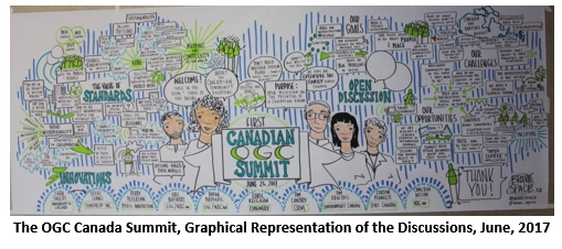
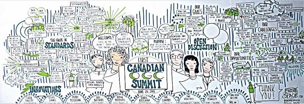
- OGC Canada Summit - St. John's, NL, June 26, 2017 - Graphic Recording
Charter Members
AE Inc., CAE, Computer Research Institute of Montreal (CRIM), Compusult Ltd., Cubewerx Inc., Ecere Corp., Environment and Climate Change Canada (ECCC), Esri Canada Ltd., Fisheries and Marine Institute (Memorial University of Newfoundland), Mount Royal University, Natural Resources Canada (NRCan), Internal Services Department - Geographic Information Services (Province of Nova Scotia), NewfoundView, the PYXIS innovation, SensorUP, Teledyne CARIS, Tesera Systems Inc., University of CalgaryCo-Chair Information
Government- Cameron Wilson, NRCan
- Bradford Dean, Mohawk Council of Kahnawake
- Aurelian Constantinescu, CAE Inc
- Julien Barbeau, Teledyne - CARIS
- Trevor Taylor, OGC
- Rosie Chen, OGC
Contact Information
For general questions, comments or ideas, please contact Trevor Taylor ttaylor@ogcNOspamPlease.orgCanadaForum Web Utilities
- WebTopicList - all topics in alphabetical order
- WebChanges - recent topic changes in this web
- WebNotify - subscribe to an e-mail alert sent when topics change
- WebRss, WebAtom - RSS and ATOM news feeds of topic changes
- WebStatistics - listing popular topics and top contributors
- WebPreferences - preferences of this web


| I | Attachment | Action | Size | Date | Who | Comment |
|---|---|---|---|---|---|---|
| |
2019 Agenda.pdf | manage | 241 K | 11 Apr 2024 - 22:19 | RosieChen | |
| |
Canada_Forum_Agenda.pdf | manage | 241 K | 11 Apr 2024 - 22:16 | RosieChen | |
| |
Taylor_-_Canada_Summit_Keynote.pptx | manage | 7 MB | 19 Oct 2018 - 13:32 | TrevorTaylor | |
| |
csummit.jpg | manage | 124 K | 20 Jun 2018 - 14:27 | TrevorTaylor | |
| |
flag.jpg | manage | 16 K | 24 Apr 2018 - 20:29 | TrevorTaylor | |
| |
graf_enhanced.jpg | manage | 454 K | 01 Aug 2018 - 19:20 | TrevorTaylor |
Edit | Attach | Print version | History: r25 < r24 < r23 < r22 | Backlinks | View wiki text | Edit wiki text | More topic actions
Topic revision: r25 - 12 Apr 2024, RosieChen
- Webs
-
 AIP8
AIP8
- ASTROdwg
- AgricultureSummit
- AustraliaNewZealandForum
- AviationDWG
- BigDataDwg
- BusinessValueCommittee
- CATdiscuss
- CDBswg
- CRSdefinitionResolver
- CRSdwg
- CanadaForum
- ChinaForum
- CitSciIE
- CitizenScienceDWG
- ClimateChallenge2009
- CoveragesDWG
- DiscreteGlobalGridSystemsDWG
- EMSpectrumDWG
- EMspectrumDWG
- ERGuidance
- EUforum
- EarthCube
- EnergyUtilitiesDwg
- GML
- GeoSciMLswg
- GeoScienceDWG
- GeocodingAdHoc
- Geospatial3DMS
- HealthDWG
- HydrologyDWG
- I15swg
- ILAFpublic
- ISGdwg
- Ideas4OGC
- JAG
- JSONsubGroup
- JapanAssistance
- LandAdminDWG
- MLSdwg
- Main
- MarineDWG
- MassMarket
- MetOceanDWG
- NREwg
- NetCDFu
- NordicForum
- OGC
- PointCloudDWG
- QualityOfService
- SWEProCitSci
- Sandbox
- SmartCitiesDWG
- System
- TemporalDWG
- UKIAP2013
- UrbanPlanningDWG
- Vocabulary
- WCTileServiceSWG
- WPS
- WaterML
If you enter content here you are agreeing to the OGC privacy policy.
Copyright &© by the contributing authors. All material on this collaboration platform is the property of the contributing authors.
Ideas, requests, problems regarding OGC Public Wiki? Send feedback